Actvity Summary: Students will learn how to read a contour map of Brothers volcano, and then create a 3D model out of designated supplies.
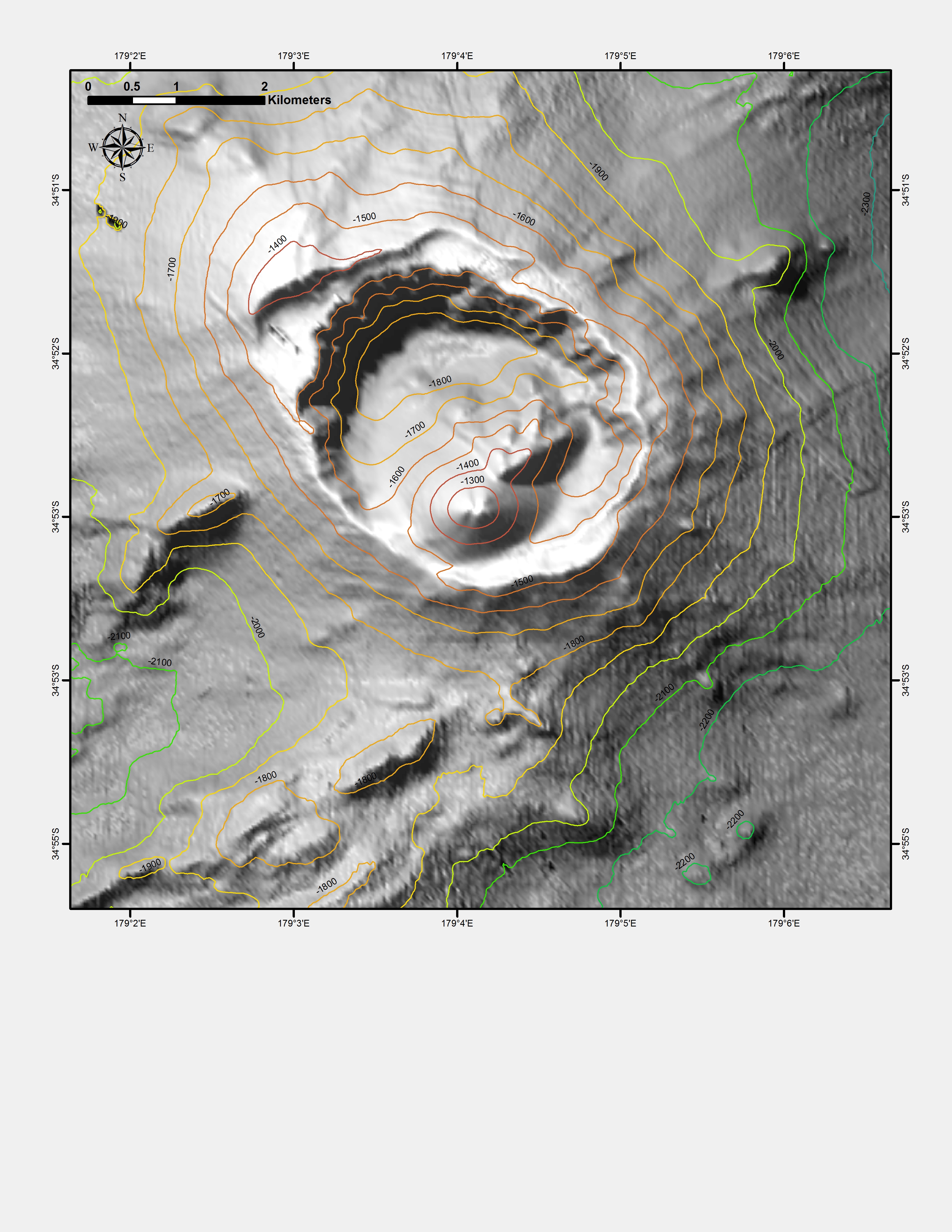
Contour maps are representations of part of Earth’s surface that use contour lines to show either elevation above sea level or depth below sea level. This activity uses a two-dimensional contour map of Brothers volcano, location of IODP Expedition 376, and extrapolates the information into a three-dimensional model.
- Standard E: Earth and space science
- Scale, proportion, quantity
- Structure and function
- Developing and using models
- ESS2.B Plate tectonics and large-scale system interactions
- LS2.B Cycles of matter and energy transfer in ecosystems
- PS2.A Forces and motion
- PS3.D Energy in chemical processes and everyday life