Arriving at our first drilling site and the first cores of the expedition!
Reaching the First Drilling Site
Our arrival to the first site has long been greatly anticipated, with an increasing excitement that had been building since we left Wellington (that seemed like so long ago). Any disappointment of being only 20 miles from the shelf site only to be turned around had completely disappeared and now after a nearly ten-day transit we were about to begin recovering sediments from a place that no one had ever penetrated deeply. I often like to think of this of the closest I will ever get to going to another planet. Indeed, it took longer for us to transit across the Southern Ocean to Antarctica than it did for the Astronauts to travel from the Earth to the Moon. On the up side of the long transit, is that it gave everyone a chance to get to know each other. On short transits, the team breaks up into two shifts abit early (there are two 12-hour shifts for the scientists).
This site (called WLRIS-06A, WL stands for Wilkes Land and RIS means the site is located on the continental rise which is the gentle slope beyond the shelf in greater than 2,000 meters of water depth) is actually a new site that was selected as a better alternative to the deepest water site we planned to drill (WLRIS-02A). This is because the sediments we most wanted were a bit shallower than the original site. Out target was the transition from the Greenhouse to Icehouse World that occurred about 34 million years ago. This is time when Antarctica switched from being mainly covered by forests to being completely covered by an ice sheet at least as big as we have today. This drilling site was hoped to be far enough away from the shelf so we would not have the avalanches of debris that comes off the shallow water areas of the shelf. These occur most frequently during when the ice sheet expands during time of maximum glaciation, with the ice sheet extending out across the shelf, bulldozing the sediments to the edge of the continental shelf, pushing them down the slope to the deep sea area.
Our first attempts were thwarted when the APC (Advanced Piston Coring) had problems penetrating the surface. After two attempts, in which the second try actually bent the pipe, it was decided to switch to the RCB (Rotary Core Barrel). The RCB can drill through just about anything as opposed to the APC, which can only pushes the drilling bits through relatively soft sediments. However, switching drill bits required for the drillers to pull up all of the drilling pipe, all 3,700 meters (almost 12,000 feet!) and put on the new drill barrel and then add the pipe back, before we could get our first core. This took time and kept the suspense of us being able to spy our first core on deck.
Finally, early in the morning the first core came up.

Moving the core barrel

Unscrewing the core catcher.

Moving the core (still in the plastic liner) to be cut into 1.5 meter long sections ( about 4.5 feet).
Nearly everyone was up (both midnight and noon shifts), with cameras and video cams armed and ready to capture the very first core of the Wilkes Land Expedition.

The team looking on.
The core catcher, located at the bottom of the core barrel, literally catches the core using pieces of metal that let the core come into the barrel but does not let it go out (at least that is the idea). It is also the first thing to come off the barrel and is opened immediately and samples are taken for the paleontologists.

yours truly waiting for the paleo sample from the bottom of the core.

The sample in hand.
Normally, the paleo people would scurry away and start processing these samples, but today was the first day and no one left the deck until the rest of the core was seen. What we saw astounded everyone. Coarse pebbly sediments that looked like they came from someone’s gravelly walkway rather than from the deep sea some 12,000 feet below sea level and something like almost 200 miles from the coastline. This was way out on the lower most part of the continental rise, with low gradients (probably so low that a marble wouldn’t down on its slope, but still we had these coarse grained material that somehow got transported to this remote distal location.

Gravels at 12,000 feet below sea level!
These sediments came to be at this deep site owing to what is called turbidity currents. Think of them as underwater avalanches that start way up at the edge of the continental shelf and then race down the relatively steep (actually no more steep than a downhill on a super highway) mile after mile down onto the continental rise at which time the slope decreases and the energy decreases resulting in the sediments to be deposited. Usually one would think that the coarse grain material would settle up on the upper most part of the rise. But here they reached far deeper than expected. While this made for some exciting looking sediments, it also made the hole far more likely to collapse as these sediments often start to fall into the hole quite quickly (as oppose to clays that stick together better).

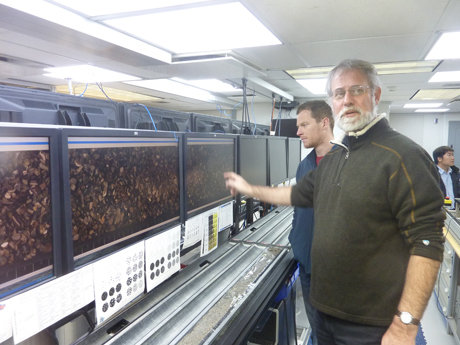
The two Robs describing the core.