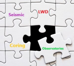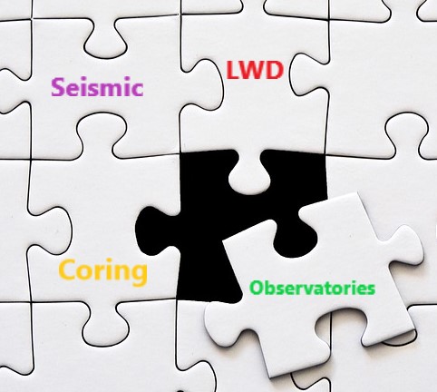
Piecing together the puzzle of the Hikurangi subduction zone
Expedition 375 is part of a much larger research effort to piece together the story of the Hikurangi Subduction Zone.
It involves funding and scientists from multiple countries, using a variety of geological techniques including logging while drilling (LWD), coring, sub-seafloor observatories and seismic surveying.
Hikurangi is a complex and dynamic subduction zone, so it is no surprise that it will take multiple approaches and views to understand it more fully.
Coring
The JOIDES Resolution is a science drilling vessel, able to drill down through 6 km of sea water (4 miles) and then under the seabed for up to 1.5 km (about a mile). The core it collects gives us samples of the material that lie below the seafloor, which we can then test in laboratories to find out its physical characteristics including things like strength, density, porosity, magnetic properties and fossil content.
But, when we bring cores of sediment and rock up to the surface they are not under the same pressure they are deep under the ground and so the measurements we make in the lab can be a bit inaccurate. Also, coring often does not capture all of the material – some of it gets washed away and lost and we cannot then measure it. For this reason, we need another puzzle piece… Logging while Drilling.
Logging while Drilling (LWD)
Our work here on #375 follows in the footsteps of a previous expedition.
In November 2017, JOIDES Resolution Expedition 372 came here to collect Logging while Drilling (LWD) data from boreholes in the same spots as our drill sites and where we recently installed our two observatories.
Logging while drilling is a technique that gives ‘real time’ measurements of the properties of sediments and rocks while they are still in the ground and undisturbed. It gives a continuous data record as we drill down from the top to the bottom of the hole, avoiding the issue of cores not recovering all the material, and it measures a number of things on the way down.
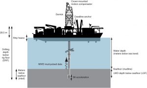
Instead of bringing up a long tube or core of sediment to analyse, the drill string that is lowered into the hole has lots of geophysical measuring equipment on it. One of these instruments uses sound waves to measure the speed of sound through rocks, which can tell us about how strong the rocks are and how they may behave during an earthquake.
Other instruments send electrical currents into the rock and measure the sediment’s electrical resistivity. When a formation is porous and contains salty water, the overall resistivity will be low. When the formation contains very low porosity and can’t accommodate much salty water, its resistivity will be high.
Rebecca Bell is one of the Core-Log-Seismic Integration specialists on board Expedition 375 and explains, “LWD gives us a continuous measurement and the data collected on Expedition 372 helped us choose the best sites and the best depths to put in our two sub-seafloor observatories”.
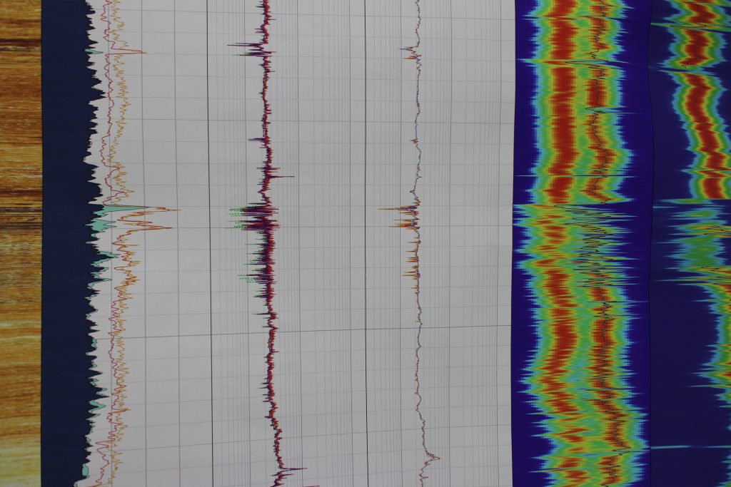
Watch this video where Becky explains how we use LWD to connect the core we are drilling (which is measured in depth) with the seismic data we have already (which is measured in time).
Seismic Surveying
Both LWD and coring give us a huge amount of information about one particular place below the seafloor. If we could drill lots of boreholes all through the Hikurangi Subduction Zone that would build up the wider picture of what rocks are underneath, and what are their physical properties, layers, ages and chemistry.
BUT drilling is very expensive and technically challenging, and New Zealand does not own any ships that can core deeper than 4-5 metres below the seafloor (NIWA’s flagship, Tangaroa for example can only carry out short piston/gravity coring and dredging).
“This is where we need the perspective that Seismic Surveying can give us to add another piece to the Hikurangi puzzle”
Seismic surveying techniques give us a 2D or 3D picture of what is below the seafloor.
The only way to determine the size and shape of faults at subduction zones to better understand earthquakes is by collecting detailed images of layers beneath the seafloor using sound waves. These images reveal the internal structure of the Earth.
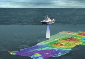
Over the years NIWA’s ship, R/V Tangaroa has collected 2D data all along the Hikurangi margin.
In December 2017 to January 2018 the R/V Langseth, a US owned research vessel, did a 3D seismic survey around some of the northern Hikurangi drill sites. This was funded by NSF (the National Science Foundation, U.S), NERC (the National Environmental Research Council, U.K), JAMSTEC (Japan) and GNS Science.
During seismic surveying, the sound waves emitted from the ship bounce down to ocean bottom seismometers, receivers close to the sea surface and, in some cases, seismometers on land nearby as well. When these data are processed, they will give us a very detailed 3D block image (similar to an ultrasound image) of the structures and architecture of the northern Hikurangi Subduction Zone.
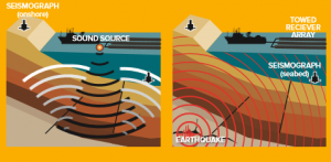
Conducting seismic surveys along the Hikurangi subduction zone fault off the East Coast helps scientists to understand the processes that control earthquakes and tsunamis.
Seismic survey data complements the data collected from the scientific drilling we are doing on Expedition 375 at 4 sites, and the LWD data already collected on Expedition 372.
The integration of all the different data types will allow us to extrapolate further along the coast too, to investigate the ‘locked’ southern Hikurangi zone where the plates are stuck and experience earthquakes more violent than slow slip events.
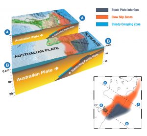
The puzzle pieces fit together
The seismic reflection data, together with cored material, observatory measurements and the LWD data will be combined by scientists over the next few years to give us a more complete picture – like individual puzzle pieces helping us see and understand the whole subduction zone.
