- Accretionary wedge
- Synonyms: accretionary prism
- Advanced Piston Corer (APC)
-
The Advanced Piston Corer (APC) is crucial for high-resolution climate and paleoceanographic studies. The APC is a hydraulically actuated piston corer designed to recover relatively undisturbed continuous 9.5 m long oriented core samples from very soft to firm sediments that cannot be recovered well by rotary coring.
- Alkalinity
-
Alkalinity is measured by titration. An acid of known strength (the titrant) is added to a volume of a treated sample of water. The volume of acid required to bring the sample to a specific pH level reflects the alkalinity of the sample. The pH end point is indicated by a color change. Alkalinity is expressed in units of milligrams per liter (mg/l) of CaCO3 (calcium carbonate).
- Anoxic
-
A total decrease in the level of oxygen, an extreme form of hypoxia or “low oxygen.”
- APC
-
Stands for Advanced Piston Corer. The APC is a hydraulically actuated piston corer designed to recover relatively undisturbed continuous 9.5 m long oriented core samples from very soft to firm sediments that cannot be recovered well by rotary coring.
- Aquifer
-
An underground layer of water-bearing permeable rock or unconsolidated materials (gravel, sand, or silt) through which water can flow.
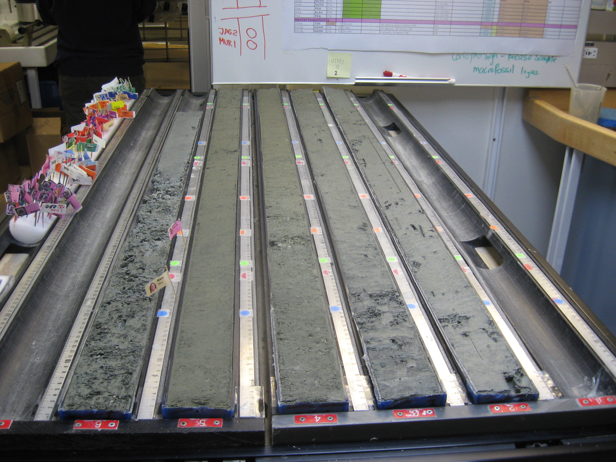
- Archive Half
-
When a core is split in half, it is the side that is saved and can only be studied without altering it so it can be preserved.
- Atoll
-
A coral island (or islands) that encircles a lagoon partially or completely.
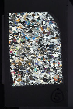
- Basalt
-
Basalt is a common extrusive volcanic rock. It is usually gray to black and fine-grained due to rapid cooling of lava at the surface of Earth.
- Basement Rock
-
The rock layers that lie underneath layers of sediments
- BHA
-
Stands for Bottom Hole Assembly. The BHA is located at the bottom of the drillstring and is made up of drill collars and the drill bit.
- Bioluminescent
-
Living organisms, such as algae or fireflies, that can produce visible light.
- Biostratigraphy
-
The study of how fossils are distributed through time and space. These patterns can often be used with other data to date the rock layers.
- Biotic Extinction
-
The complete death and disappearance of a life form. This term is more inclusive than the extinction of a species.
- Bridge
- Caliper
-
Caliper is a tool used for measuring the diameter of a borehole. The measurements are displayed as a caliper log. Open hole caliper logging tools often have four or more arms.
- Catwalk
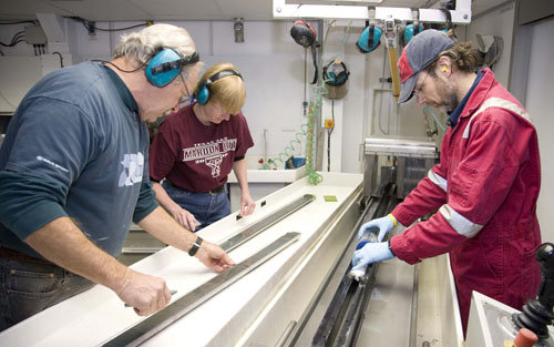
-
The catwalk is the core receiving platform; it is a covered area outside the Core Lab where each core is handed over to the Lab technicians that clean, measure, and cut it into ~1.5 meter sections.
- Cenomanian-Turonian Boundary
-
93 million years ago a large Ocean Anoxic Event occurred marking the boundary. At this time the oceans were deprived of oxygen and over 25% of marine invertebrates went extinct. Large charismatic marine reptiles such ichthyosaurs and pliosaurs were also wiped out.
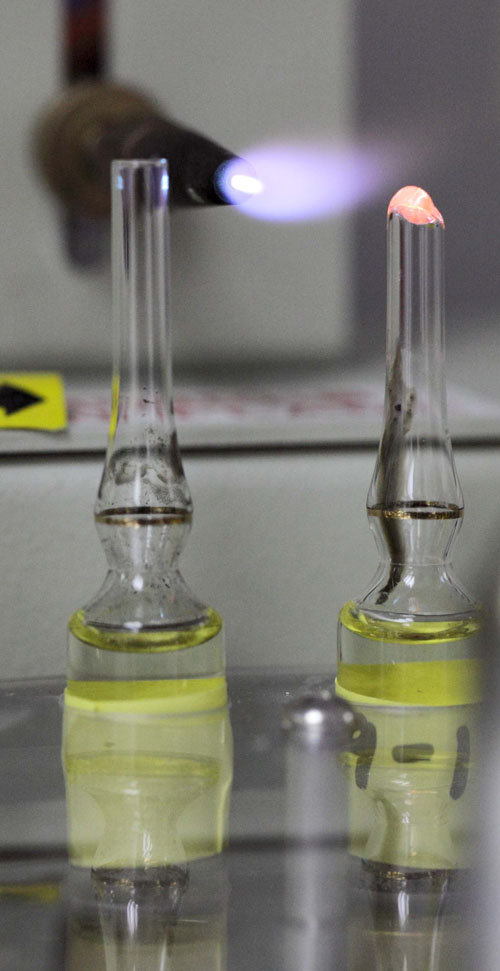
- Chemistry
-
Chemistry is a physical science that deals with the composition, structure and properties of substances and the transformations they undergo. The JR has a large chemistry lab on the Forecastle Deck.
- Climate Change
-
A long-term change in weather patterns
- Contourites
-
Contourites are the sediments deposited by, or significantly affected by, bottom currents (e.g. Mediterranean Outflow Water in the Gulf of Cádiz)
- Core Barrel
-
A hollow cylinder used for obtaining cores that is dropped inside the drillstring<
- Core Catcher
-
A one-way device that prevents a core from falling out from the inner core barrel once it has entered
- Core Lab
-
Lab designed specifically for the description and analysis of sediment and hard rock cores
- Core Sample Archive Half
-
When a core is split in half, it is the side that is saved and can only be studied without altering it so it can be preserved.
- Core Sample Working Half
-
When a core is split in half, it is the side that can be tested and studied by scientists.
- CORK
-
Stands for Circulation Obviation Retrofit Kit. A CORK is a set of scientific instruments designed to monitor conditions beneath the ocean floor.
- Derrick
-
A derrick is a tower that holds the hoisting apparatus for raising and lowering the drilling apparatus on the ship.
- Detritus
-
Small particles, debris, other material worn or broken away from a mass by water or glacial ice
- Downhole Logging
-
Lowered instruments down into a drilling hole to collect measurements of the physical properties of rocks and sediments
- Drill collars
-
Thick, heavy pipes that provide weight on the drill bit, so that it can drill into the seafloor. They are located at the bottom of the drill string, forming part of the bottom hole assembly (BHA).
- Drill Pipe
-
The drill pipe is the pipe that surrounds the core sample and core liner. It has a drill bit at the bottom that drills through the rock to make the core.
- Drill Shack
-
The drill shack is the room from which drilling operations are controlled.
- Drillstring
-
The drillstring on The JR is a column, or string, of pipes that transmits drilling fluid (via the mud pumps) and rotational power to the drill bit at the bottom.
- Dropstone
-
Rock fragments that range in size from small pebbles to boulders. The critical distinguishing feature is that there is evidence that they were not transported by normal water currents, but rather dropped in vertically through the water colum. Dropstones are often carried and deposited by melting icebergs.
- Drydock
-
To remove a ship from water to a dry basin, typically for repairs
- Dynamic Positioning System
-
Dynamic positioning (DP or DPS) is a computer controlled system that automatically keeps a ship in its position and heading (called “on station”) by using her own propellers and thrusters.
- Earth’s magnetic field
-
the magnetic field generated by flow of iron in Earth’s outer core. The magnetic field extends from the Earth’s core into space and helps to deflect solar winds that would strip away the ozone layer. Currently, the Earth’s magnetic field is oriented so that the magnetic north pole is in the north; however, at random intervals in Earth’s past, the magnetic field orientation has reversed, so that the magnetic north pole was in the south.
- ELMO
-
See Eocene Layer of Mysterious Origin.
- Eocene Layer of Mysterious Origin
-
(ELMO) Period of global warming that occurred approximately 53.7 million years ago (Ma). It appears to be the second major hyperthermal that punctuated the long-term warming trend from the Late Paleocene through the early Eocene (58 to 50 Ma).
- Erosion
-
The movement of rocks and minerals to another place by ice, water, wind or gravity.
- Extended Core Barrel (XCB)
-
The Extended Core Barrel (XCB) coring system is used in sedimentological, climate, and paleoceanographic studies.The XCB is used to recover 9.5 m long core samples from soft to moderately hard formations. The XCB is typically deployed when the formation becomes too stiff to piston core (i.e., upon piston coring “refusal”) or when it is not hard enough to permit efficient recovery with the Rotary Core Barrel (RCB). The XCB cutting shoe extends ahead of the main bit in soft sediments but retracts into the main bit as the weight on bit increases when firm lithologies are encountered. The XCB uses the same bottom-hole assembly (BHA) as the Advanced Piston Corer (APC).
- Fantail
-
The fantail is an overhang at the extreme rear of the ship. On The JR, it is the same as the poop deck.
- Forecastle (Foc’sle) Deck
-
A partial deck above the main deck at the bow
- Gabbro
-
Gabbros are dark igneous rocks formed when liquid magma is trapped under the Earth’s surface and cools there. Large portions of the oceanic crust are made of gabbros.
- Galley
-
The area of the ship where food and meals are prepared and served
- Gas Hydrates
-
Ice-like minerals that form at low temperatures and high pressures in the deep sea. These hydrates contain gases, such as methane, that are trapped within the structure of the hydrate crystals.
- Geochemistry
-
The field of geochemistry involves study of the chemical composition of the Earth and other planets, chemical processes that govern the composition of rocks and soils, and the cycles of matter and energy that transport Earth’s chemical components in time and space, and their interaction with the hydrosphere and the atmosphere.
- Geological Layers
-
Geological layers refer to layers of rocks and sediments with different textures and compositions that are found on land and beneath the ocean floor
- Geology
-
Geology is the science and study of the history of Earth and its life especially as recorded in rocks and sediments.
- Geophysics
-
Geophysics is the branch of earth science dealing with physical processes and phenomena the occur on Earth, such as earthquakes.
- Geoscientists
-
Scientists who study geology, geophysics or geochemistry.
- Greenhouse
-
The planet’s climate has been fluctuating between two dominant states: the Greenhouse and the Icehouse. These two climate sets generally last for long periods of time (many millions of years) and should not be confused with Ice ages or Glacial and Interglacial periods. A “Greenhouse Earth” or “Hothouse Earth”, is a period in which there are no continental glaciers whatsoever on the planet, the levels of carbon dioxide and other greenhouse gases (such as water vapor and methane) are high.
- Greenhouse Conditions
-
Refers to warm environmental conditions, such as during the early Eocene, when the Polar Regions were free of ice and there were relatively high levels of carbon dioxide in the atmosphere
- Greenhouse Effect
-
An atmospheric heating phenomenon caused by carbon dioxide, water vapor, methane, and other gases trapping more of Sun’s heat, resulting in higher temperatures on Earth’s surface
- Hold Deck
-
The very bottom deck of the ship, used for storage
- Hotspot
-
An area of volcanic activity that is found within a tectonic plate and is not caused by a subduction zone. Hawaii, Yellowstone and the Louisville Seamount Trail are all examples of hotspots.
- Hull
-
The body of a ship that provides buoyancy
- Hydrogeology
-
The study of water in the Earth’s crust
- Hydrogeology
-
The study of water in the Earth’s crust.
- Hyperthermal
-
Geologically brief time intervals (<200,000 years) of global warming and massive carbon input.
- Icehouse
-
The planet’s climate has been fluctuating between two dominant states: the Greenhouse and the Icehouse. These two climate sets generally last for long periods of time (many millions of years) and should not be confused with Ice ages or Glacial and Interglacial periods. An “Icehouse Earth” is a period in which continental ice sheets are present, and wax and wane throughout time known as glacial (ice age) and interglacial periods. During an Icehouse Earth, greenhouse gases tend to be less abundant, and temperatures tend to be cooler globally. The Earth is currently in an icehouse stage – ice sheets are present on both poles.
- Icehouse Conditions
-
Refers to glacial environmental conditions, such as during the early Oligocene, when the Polar Regions were covered in ice and there were relatively low levels of carbon dioxide in the atmosphere
- Igneous
-
A type of rock that has cooled and solidified from magma (inside the earth) or lava (on the surface of the Earth).
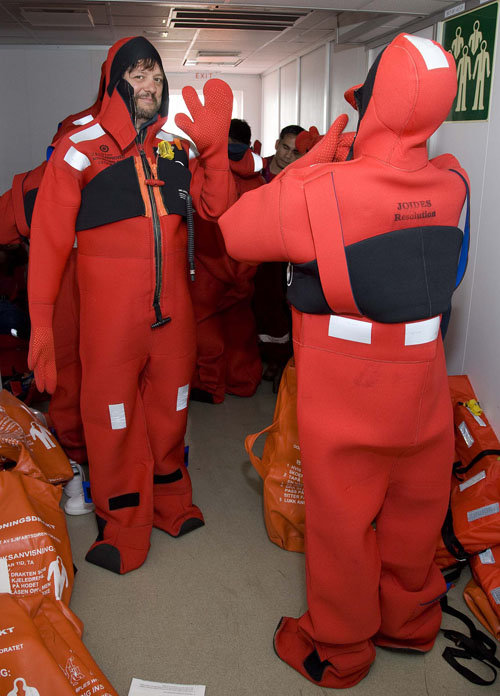
- Immersion Suit
-
A special type of waterproof dry suit (also known as a Gumby suit) that protects the wearer from hypothermia from immersion in cold water, after abandoning a sinking or capsized vessel
- Iron Roughneck
-
The piece of equipment that attaches sections of drill pipe to each other, much like a large, mechanical wrench
- Isotope
-
Isotopes are atoms of the same element that have the same atomic number (the same number of protons and electrons) but different atomic weights (different numbers of neutrons).
- Joint
-
On The JR, three 9.5 meter joints of drill pipe are threaded together to make a single stand of pipe.
- K-Pg
-
The K-Pg, or Cretaceous-Paleogene boundary, marks the mass extinction event 65.5 million years ago that is most famous for killing the dinosaurs.
- Lab stack
-
The multi-floor area of the ship that houses all the scientific laboratories on board the ship
- Lithosphere
-
The outermost shell of the Earth that includes the crust and the uppermost portion of the mantle. The lithosphere is rigid, yet able to bend, move, fracture and break into tectonic plates.
- Logging
-
Lowering instruments down into a drilling hole to collect measurements of the physical properties of rocks and sediments
- Logging Scientist
-
A person who analyzes data from logging instruments – those lowered down into a drilling hole to collect measurements of the physical properties of rocks and sediments.
- Magnetic anomaly
-
A local variation in Earth’s magnetic field resulting from variations in the chemistry and/or magnetism of rocks. Magnetic anomalies found in bands of oceanic floor parallel with mid-ocean ridges record reversals in Earth’s magnetic field over millions of years.
- Main Deck
-
The highest deck of the hull, usually but not always the weather deck
- Marine Biology
-
Marine biology is the scientific study of living organisms in the ocean or other marine or brackish bodies of water.
- Marine Geophysics
-
Geology that deals with the physics of the ocean, including seismology, volcanology, and geomagnetism
- Mbrf
-
Meters Below Rig Floor or MBRF adds the vertical distance between the water line and the rig floor to Meters Below Sea Level or MBSL. The height of the rig floor above the water line changes as we use fuel, pump ballast, take on supplies, etc.
- Mbsf
-
Meters drilled or logged below seafloor.
- MECO
- Mediterranean Outflow Water
-
The Mediterranean Outflow Water (MOW) corresponds to the water flow coming from the Mediterranean Sea into the Gulf of Cadiz through the Straits of Gibraltar.
- mid-ocean ridge
-
Underwater mountain chain with peaks generally lying approximately 2-2.5 km below the sea level. The ranges typically have a valley known as a rift running along the spine. Mid-ocean ridges are formed as a result of plate tectonics: at mid-ocean ridges, new ocean floor is created through molten material welling up from the underlying mantle and cooling to form basalt. As new ocean floor is formed, older ocean floor is pushed away from the mid-ocean ridge on either side of the ridge axis, making the mid-ocean ridge roughly symmetrical.
- Middle Eocene Climatic Optimum
-
After the PETM the Eocene climate went through a period of general cooling with a series of hyperthermals. The Middle Eocene Climatic Optimum (MECO) occurred42 million years ago a sharp increase in carbon dioxide caused a warming trend that lasted about 600,000 years..
- Monsoon
-
A seasonal shift in the prevailing wind direction, which usually brings different kinds of weather. For example, in southern Asia, the wind blows from the southwest from April to October and from the northeast the rest of the year. The moist southwest winds bring heavy rainfall, often causing flooding.
- Moon Pool
-
A moon pool is an opening in the floor of the ship, giving access to the water below, allowing technicians or researchers to lower tools and instruments into the sea.
- MOW
-
Stands for Mediterranean Outflow Water.
- OAE
-
See Ocean Anoxic Event.
- Ocean Anoxic Event
-
Also known as an OAE, it is an event where the oceans become completely depleated of oxygen. OAEs have happened many times in the past and are often associated with mass extinction events.
- Oceanic Circulation
-
The circulation of large-scale ocean currents that is driven by differences in the density of seawater at different locations. The density of seawater changes depending on how much surface heat and freshwater it receives.
- Oligocene-Miocene Boundary
-
Occured 23 million years ago. It is not set at an easily identified worldwide event but rather at regional boundaries between the warmer late Oligocene and the relatively cooler Miocene.
- Orogeny
-
The process of mountain formation, especially by folding and faulting of the Earth’s crust.
- OsmoSampler
-
A device consisting of an osmotic pump connected to a long section of small-bore tubing used to collect water samples
- Paleclimatology
-
Paleoclimatology is the study of climate change taken on the scale of the entire history of Earth. It uses records from ice sheets, tree rings, sediment, and rocks to determine what climate was like in the past.
- Paleo Combo
-
The Paleo Combo is a downhole logging tool that measures the natural gamma radiation, density, and magnetic susceptability (amount of magnetic material) in the sediment.
- Paleocene-Eocene Thermal Maximum
-
Also called the PETM, the Paleocene-Eocene Thermal Maximum was a super-warm climate event that occured 55 million years ago. During this time, the Earth released massive amounts of greenhouse gasses and temperatures rose to the highest levels in the last 80 million years. During the PETM there was no ice on Earth. It was so warm that the poles were covered in cyprus swamps and redwood forests. The PETM is also characterized by a mass extinction of foraminifera in the deep sea.
- Paleomagnetism
-
Paleomagnetism is the study of the record of the Earth’s magnetic field preserved in various magnetic minerals through time.
- Paleontology
-
Paleontology is the study of the history of life on Earth, as reflected in the fossil record.
- Peer Review
-
The evaluation of a scientist’s work, usually in the form of a paper, by other scientists to ensure good science has been conducted
- Pelagic sediment
-
Fine-grained sediment that accumulates as the result of the settling of particles to the floor of the open ocean, far from land. Often made up of the hard parts of microscopic marine organisms.
- PETM
- Petrophysics
-
Petrophysics is the study of the physical and chemical properties that describe the occurrence and behavior of rocks, soils and fluids.
- Physical Properties
-
Physical properties describe the physical characteristics of rocks and sediments such as appearance, texture, color, odor, density, solubility, porosity, magnetic, and other properties of rocks and sediments. The JR has many physical properties instruments housed in the core lab.
- Physical Sciences
-
Physical science is an encompassing term for the branches of natural science that explore non-living systems, in contrast to the biological sciences.
- Poop deck
-
The poop deck is a partial deck above a ship’s main afterdeck (toward the back of the ship).
- Radiometric dating
-
a technique used to age-date rocks (or other materials) through measurement of the abundances of radioactive isotopes and their decay products found within the rock. The age is calculated based on the known decay rate of radioactive isotopes.
- RCB
-
Stands for Rotary Core Barrel. The RCB is a rotary coring system designed to recover core samples from firm to hard sediments and igneous basement.
- Reentry Cone
-
The Reentry Cone and Casing (RECC) system is a permanent seafloor installation (or legacy hole) that helps scientists return to and re-enter a particular hole.
- Rhyzon samplers
-
Rhyzon samplers are soil moisture probes that enable discrete sampling with minimal disturbance to the sediment surface. The method does not require filtering or removal of wet sediment from the piston core.
- Rotary Core Barrel (RCB)
-
The Rotary Core Barrel (RCB) is a rotary coring system designed to recover core samples from firm to hard sediments and igneous basement. The RCB is crucial for oceanic crustal hard rock studies.
- Salinity
-
The amount of salt in seawater, usually measured in parts per thousand
- Seamount
-
A mountain in the sea that is at least 100 meters high and is not found on a continental shelf.
- Sediment Drift
-
Sediment, such as sand, mud, silt, and clay, carried and deposited by deep ocean currents.
- Sedimentology
-
Sedimentology is the study of sediments such as sand, mud (silt), and clay, and understanding the processes that deposit them. Sand, silt, and clay are defined according to their grain sizes, with sand composed of coarser grains and clay composed of finer grains.
- Seismic Exploration
-
Seismic exploration is the search for geologic resources such as crude oil, natural gas, and minerals by using sound waves to produce images of the rock layers below Earth’s surface. Seismic maps are helpful in determining the best places to drill.
- Seismic reflection
-
Seismic reflection is a method of geophysical exploration that uses the principles of seismology to estimate the properties of the Earth’s subsurface from reflected seismic waves. The method requires a controlled seismic source of energy, such as an “air gun”.
- Splice
-
The splice is a composite core section representing the best available representation of a complete stratigraphic column at a site. It is composed of core sections from adjacent holes such that coring gaps in one hole are filled with core from an adjacent hole.
- Stratified Water
-
Water stratification occurs when water with different salinity (halocline) and/or temperatures (thermocline) form a barrier because their properties prevent them from mixing.
- Stratigraphic Correlation
-
The process of taking observed and recorded data on multiple cores, and using the similarities to create a composite view of the area sampled. Because of the wiggle in data from multiple holes, this is sometimes called “Wiggle Watching”.
- Submarine fan
-
A fan- or cone-shaped accumulation of land-derived sediment on the deep seafloor, located off the seaward opening of large rivers and submarine canyons. They are associated with large-scale sediment deposition, typically delivered by turbidity currents.
- Survival Suit
-
A survival suit (or more specifically an immersion survival suit), is a special type of waterproof dry suit that protects the wearer from hypothermia from immersion in cold water, after abandoning a sinking or capsized vessel.
- Terrigenous sediment
-
Sediments that are derived from land. Sources include the weathering and erosion of the continents and volcanic eruptions.
- Thermistor
-
A temperature-sensitive resistor used to measure temperature
- Thrusters
-
A thruster is a small (relatively) propulsive device used by a ship to keep it in a particular position. The JR has 12 thrusters that are controlled by the Dynamic Positioning System.
- Time Series Analysis
-
Time series analysis is the study and interpretation of data taken at equally spaced time intervals.
- Tripping pipe
-
“Tripping” simply means raising or lowering the drill string
- Turbidites
-
A sedimentary deposit formed by a turbidity current. They show a characteristic fining upward sequence: coarser grains near the bottom and finer grains towards the top.
- Turbidity currents
-
Turbidity currents can be set into motion when mud and sand on the continental shelf are loosened by earthquakes, storms, collapsing slopes, and other geological disturbances. The turbid water then rushes downward like an underwater avalanche, picking up sediment and increasing in speed as it flows.
- Tween Deck
-
These are smaller storage levels/partial decks within the hold deck. The JR has an upper and a lower tween.
- Vertical Seismic Profile (VSP)
-
A VSP differs from a conventional reflection profile in that the receiver is clamped successively at different borehole depths within the Earth.
- Weathering
-
The breaking down of rocks, soils, and minerals through contact with the Earth’s atmosphere, biota and waters.
- Working Half
-
When a core is split in half, it is the side that can be tested and studied by scientists.
- XCB
-
Stands for Extended Core Barrel. The XCB is used to recover 9.5 m long core samples from soft to moderately hard formations.