3407 nautical miles – how do we get to New Zealand?
While we are still transiting from Fremantle to New Zealand, I got curious about navigation. How is the course planned? How do weather and ocean currents affect plotting a course? How has technology changed the way ships are navigated around the ocean? Thankfully, Second Mate Edmund Ancheta was kind enough to answer my questions again. His responses are paraphrased below.
What are the different ways the ship’s track is planned and followed?
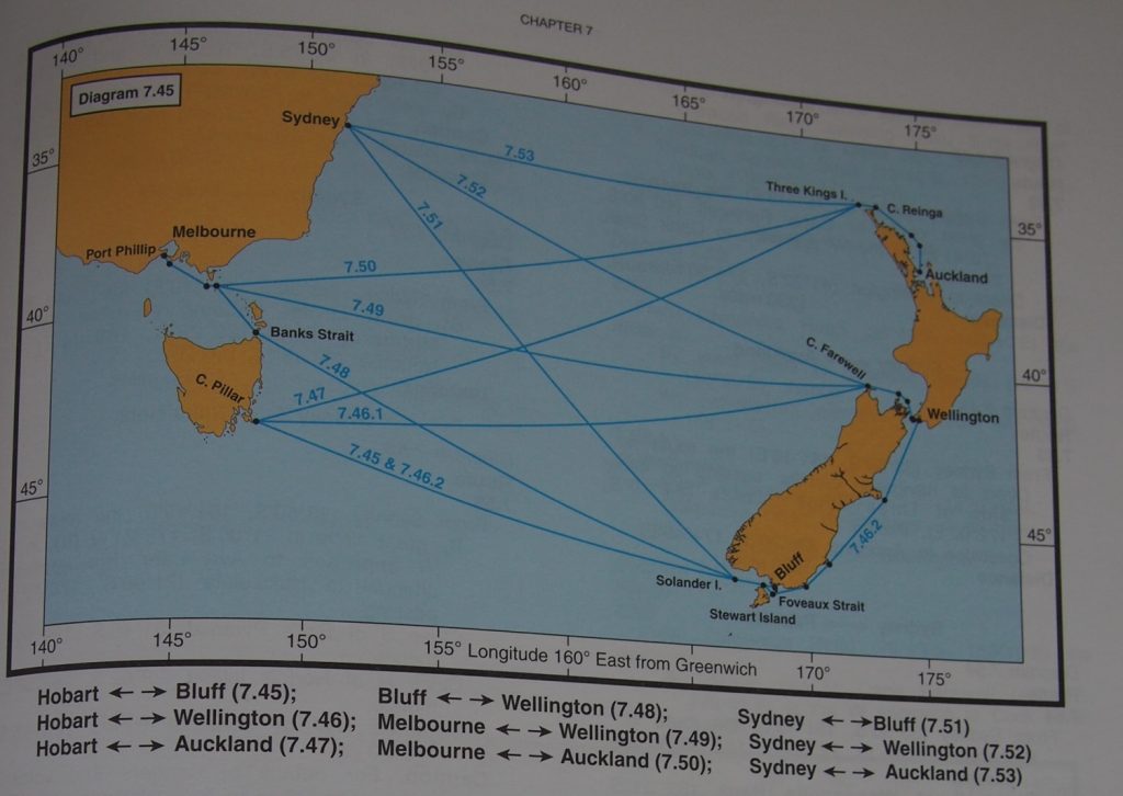
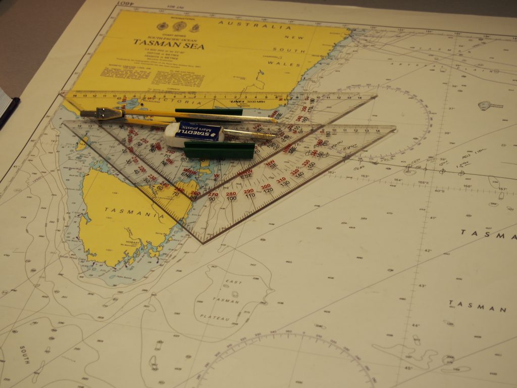
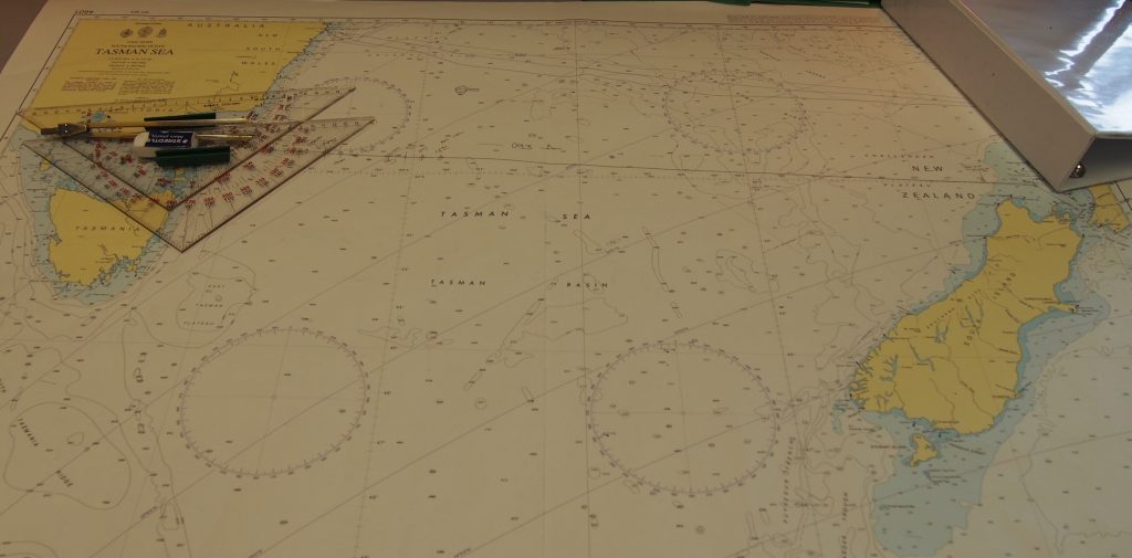
The passage undertaken by a ship is chosen based on the shortest and safest route between two ports. To assist navigation officers in passage planning, the International Maritime Organization (IMO) produces and distributes publications that provide guidelines and regulations for reference. Passage planning is done in 4 phases: Appraisal, Planning, Execution, and Monitoring. During the appraisal phase, the navigation officer must gather all relevant charts, physical and electronic, guidelines, and regulations for each port of call. Once all these resources have been gathered, the course is plotted on the charts and distances between way-points along the passage are calculated during the planning phase. At this point, the navigation officer and the captain review the planned course together and the captain gives the order to execute plan if it is satisfactory. During the execution phase, the officer on watch navigates the ship from port to port according to the passage plan. To monitor the journey, the officer on watch (the 2nd and 3rd mates for the JOIDES Resolution), records the position of the ship every hour and ensures that the ship remains on course for the duration of the passage. Additionally, the ship’s computer records the position every minute.
What are some of the challenges with navigation?
Navigation officers are constantly checking the weather to determine the risk of adverse weather conditions along the passage. If a large, dangerous weather system is in the path of the ship, the captain may give the order to slow or stop the ship and “wait on weather,” or navigate the ship around the dangerous weather system. In these situations, there are detailed guidelines in the Marine Operations Manual (another IMO publication). Shipping companies will also have detailed guidelines on what to do in the event of large, dangerous weather systems.
Another challenge with navigation is related to narrow shipping channels. Although the ocean is a huge place, ships are often transiting from large port to large port and ship traffic can get congested, especially in narrow channels. The IMO produces details about narrow passages in various countries with guidelines on where ships should be and how they should pass each other.
How has technology changed the way navigation is done?
Nautical charts showing coast lines, islands, and water depth used to only be available on paper. While paper charts are still carried and used on ships, digital versions of the charts are available on the Electronic Chart Display and Information System (ECDIS) on the bridge. This allows the passage to be plotted digitally and tied in to the Global Positioning System (GPS) that provides the position of the ship.
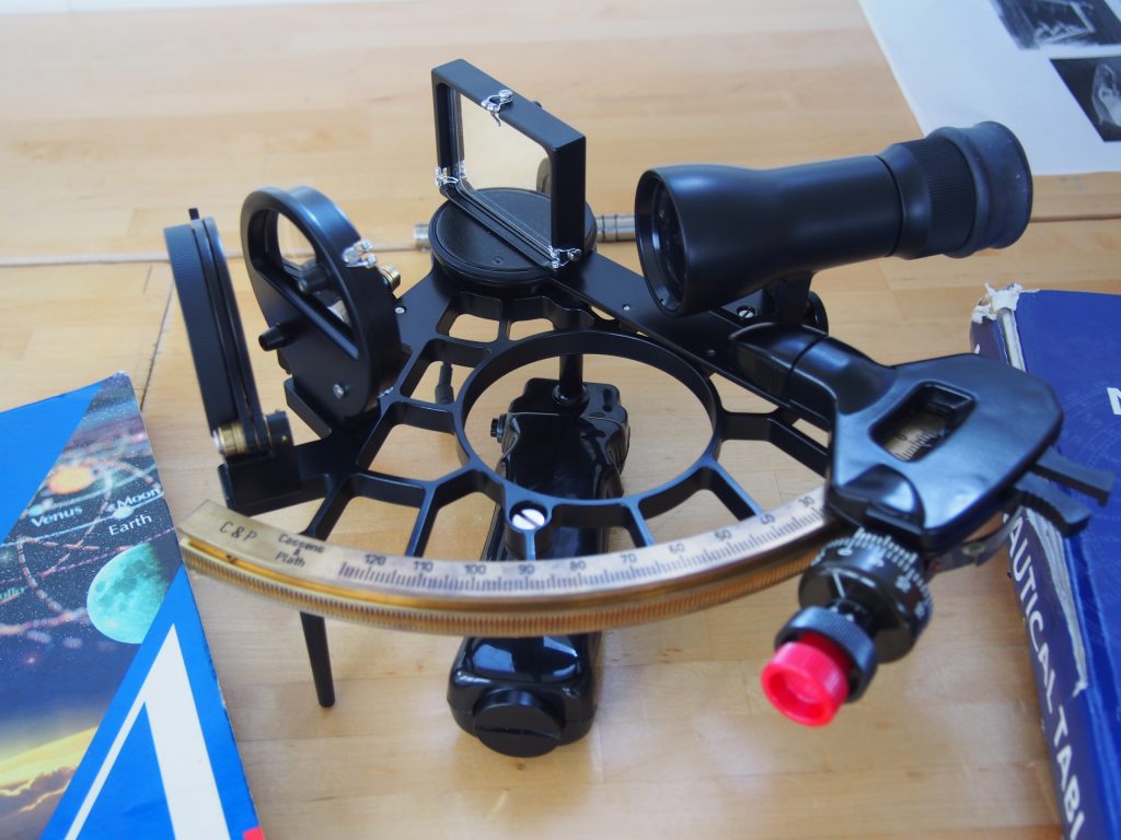
The ship’s position is primarily determined with the GPS sensor on the top of the ship. This sensor communicates with satellites to determine the position of the ship. The position is also determined with a sextant when the skies are clear and stars are visible. A sextant is a tool to assist with celestial navigation, or navigation by measuring the angle between particular stars and the horizon. These angles allow you to calculate your position on a nautical chart. Edmund showed me his last calculation with the sextant – his calculated position was very close to the position determined by the ship GPS!!
While the old navigational systems are still used, technology has made navigation easier!