Explore the Louisville Seamount Trail using Google Earth
Google Earth is a free, downloadable program that allows anyone to actively explore the geography and topography of the entire world, including the ocean floor. With an lcd projector or a smartboard, it can easily be projected for an entire classroom of students to see, and can help visual learners have a better understanding of where in the world the JOIDES Resolution is right now and what the Louisville seamount trail looks like.
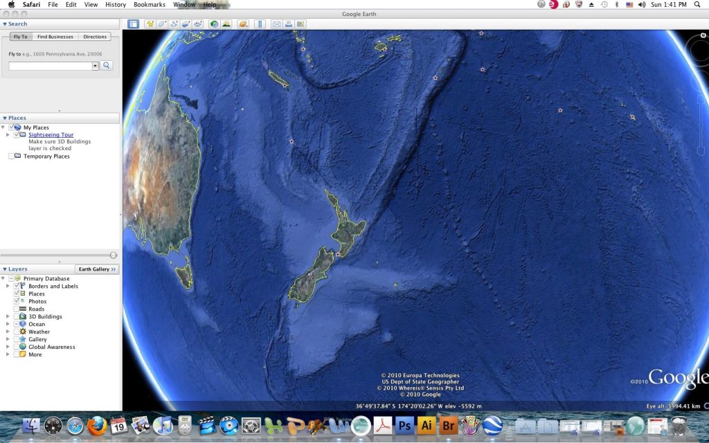
Here is how to view the Louisville seamount trail using Google Earth. First, open Google Earth, click “View” on the top bar and if there is a checkmark next to “Water Surface,” click it until it disappears. Next bring the mouse icon over the image of the Earth, hold the mouse button and drag to rotate the Earth until New Zealand is visible. Double click just to the northeast of New Zealand to zoom in the image of the Earth. Have students look closely and discuss what they observe. In particular, have them look for the long line of bumps in the ocean that are almost in a straight line. Once they have identified this as the Louisville Seamount trail, have them look for other seamount trails in the Pacific, including Hawaii and discuss how they are they all similar.
You can also give your learners a sense of the time difference between the JR and the US by clicking the sunrise icon at the top of the Google Earth screen. This will cause the divisions between day and night to be visible on the Google Earth image in real time.
There is a lot more you can do in your classroom with Google Earth than what I just described. To download Google Earth for free, visit: http://www.google.com/earth/download/ge/