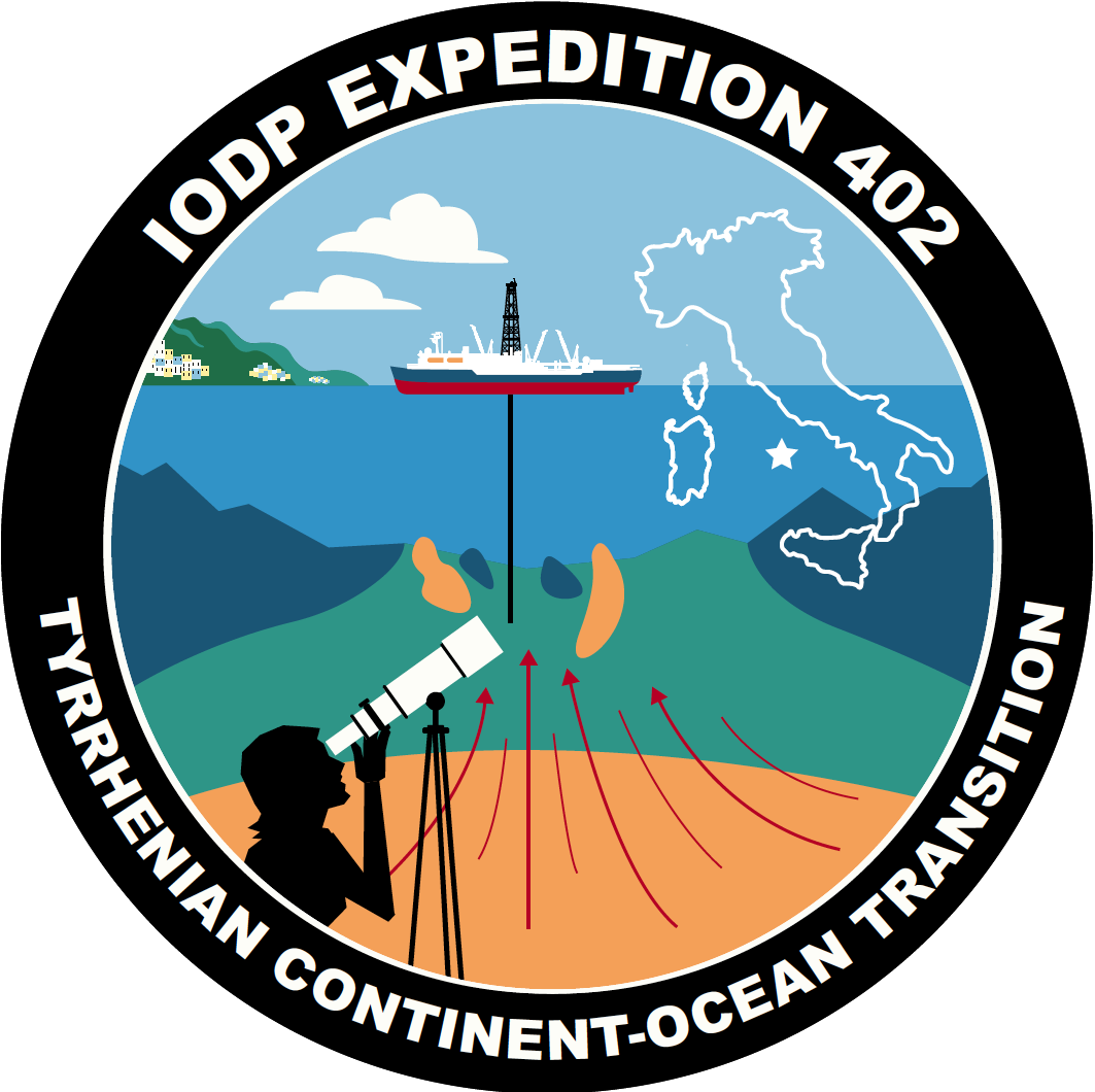
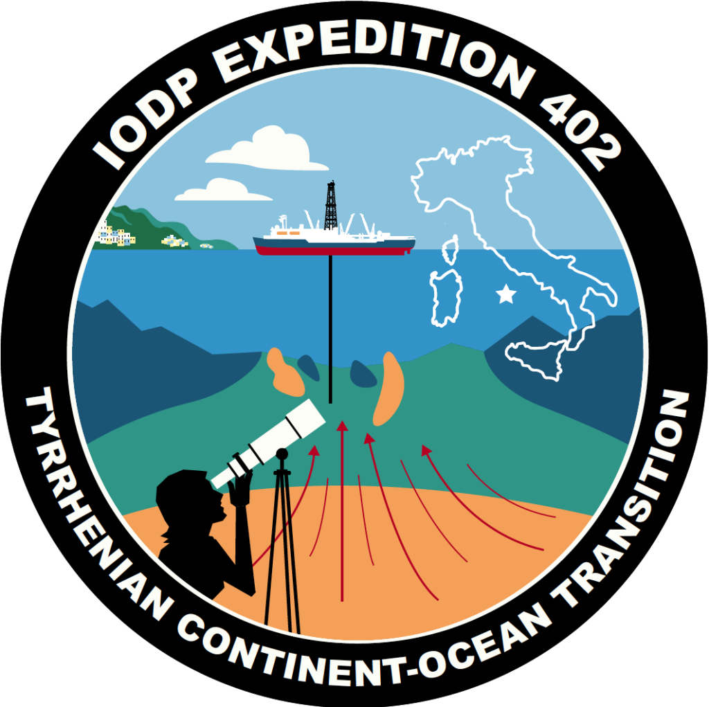
Tyrrhenian Continent Ocean Transition
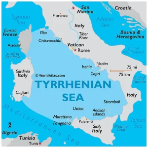
The Tyrrhenian Sea takes its name from the Tyrrhenians, a name used to refer to the Etruscan people by ancient greek poets. This civilization flourished in the 1st millennium B.C., largely based on iron trade, fueled by mines in the Elba Island, which is located just at the northern tip of the Tyrrhenian Sea. The Etruscans ended up taking part in the early Roman civilization concurrent to Rome’s cultural and artistic traditions, including the spectacle of gladiatorial combat, hydraulic engineering, temple design, and religious ritual. Known for their navigational expertise, they became a major Mediterranean trading power.
Taking a cue from the seafaring Tyrrhenian people who embraced innovation and sea voyaging, so too will the brave crew of Expedition 402 venture out to sea to get answers about our Earth.
Although there is a rich history on the water’s surface, Expedition 402 is more interested in what has been going on beneath the sea surface and the seafloor (around 12,000ft below!!). The Tyrrhenian seafloor is special because the tectonic plate that forms it stretched until it ripped like taffy being pulled, exposing the elusive rocks of the upper mantle that typically lie several kilometers below the Earth’s surface. That is the part of the seafloor we are after!
How does this research help us?
The samples of the oceanic crust and exposed mantle will give us tangible data to build on our current knowledge and answer the following questions:
- How does tectonic plate movement and stress lead to volcanism and earthquakes? The more we know about these events, the better safety measures we can take.
- How do ocean basins form? The sediment record will offer a rich, detailed archive of climate history of this part of the Earth, like when it was more wet, dry, hot, or cold and when the Earth had higher or lower sea levels.
- How do continents form and move around? It helps to better understand the formation of continental margins and ancient supercontinents like Pangea and to better predict plate motions and their future effects.
- How does magma push through the crustal layer to make new crust? This adds to our understanding of natural geological processes like volcanic eruptions. It also can help us understand what kinds of minerals we can expect to find in different geological formations that are economically important to society.
- How does gaseous carbon dioxide get trapped to form solid minerals within crustal rocks? A process that could help us understand and combat climate change.
What is the mantle, and the crust?

The mantle is one of the layers that makes up the Earth. Life, including us, spends our days on the topmost layer called the crust on Earth (see image above). Below the crust lies the upper mantle which is a layer of heated rock that typically is too deep for us to reach via drilling either on land or at very old ocean basins. The upper mantle is typically 30-50 km below the Earth’s surface like in New York or Germany.
But in the Tyrrhenian Sea, the mantle is almost outcropping in the center of the Basin, just below a few hundred meters of sediments.
The Tyrrhenian Sea basin is very young geologically speaking. Relatively speaking, a young 15 million years compared to the Atlantic Ocean pushing 150 million! Age is nothing but a number, however in this case, it’s important because it means less time for sediment to pile up to cover the mantle and oceanic crust we are targeting. While the Tyrrhenian has a sediment thickness of about 400m, the margins of the Atlantic Ocean are covered by several kilometers of sediment. Sediment is all the sand, mud, clay, and microfossil shells that fall onto the seafloor.
A thinner sediment layer means we won’t drill for long before hitting the hard rock we’re targeting. Nevertheless, that doesn’t mean the sediment is less important than the hard rock! Sediment holds lots of information for our micropaleontologists, microbiologists, and sedimentologists to study. For example, the age of the oldest sediment will tell us the time when the deep Tyrrhenian Sea formed.
Retrieving samples from the Continental Oceanic Transition (COT) is another major focus of our mission. Typically the COT, which is the boundary between continental and oceanic crust (hence the name “transition”) is hard to sample because of the thick layer of sediment that sits at the top, but due to the Tyrrhenian Sea’s youth we will have an easier time drilling into the COT. Sampling the COT of the Tyrhenian basin will help us better understand how COTs form globally.
What makes expedition 402 different from other expeditions?
The JOIDES Resolution has completed over 120 expeditions where it has visited over 600 different drilling locations over the last 45 years. However, that doesn’t mean each expedition is the same. In fact, to propose a JOIDES Resolution expedition the proposal has to be of interest to a number of different scientific fields and the proposed research must be original or novel.
The novelty of Expedition 402 is that it is focused on sampling the rocks beneath the sediment, and map where they consist of upper mantle material or where they are basaltic lavas erupted onto the seafloor. Basaltic lava is a hard volcanic rock that is typical to find in the Earth’s crust.
Where is the ship going?
The ship will sample from both oceanic crust and exposed mantle at 6 different sites in the Tyrrhenian sea (pictured below as orange circles) starting from Naples, Italy.
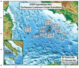
Expedition 402 will drill two perpendicular transects. One transect will go from east to west and target the part of the seafloor that progresses from basaltic crust to exposed mantle. Meanwhile the second transect will go from north to south and will map the fault zone or the “rip” in the plate that exposes the exhumed mantle. Drilling in these two directions helps answer the questions about what is happening to the tectonic plate as it is being stretched, how does the mantle and crust change over time as it is exposed to seawater, and what are the characteristics of the crust at the continent-ocean transition.
Our deepest drill site sits under 3600m of water while the shallowest site is about 2700m. Each drill site will bring up samples of sediment and hard rock, which will keep everyone busy.
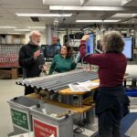
Who is on the ship?
Come meet our extremely diverse science party in the labs as they collect and analyze the seafloor samples. The International Team is a made up of numerous skills of:
- Paleontologists
- Petrologists
- Structural Geologist Paleomagnetist
- Sedimentologists
- Physical properties specialists
- Inorganic and Organic GeoChemists
- Microbiologists
The scientists are able to focus on their task at hand because the rest of the ship’s crew is focusing on maintaining the ship at peak performance as a large interacting community! On our media pages you’ll also get to meet our friendly crew made up of:
- Hospitality team
- Engineering team
- Drilling team
- Sailing team
- Catering team
The ship runs like its own city. The best part is you get to visit us!
Please join the two outreach officers, Tessa and Larkin, onboard virtually to get a personalized tour of the ship’s drilling operations, scientific laboratory, the ocean views, and the Captain’s bridge (where they steer the ship).
All you need to do is email us at thejoidesresolution@gmail.com!
Unsure of what you are signing up for? Click here to watch an explanatory video of what it is like to be on a ship to shore virtual tour. Tours can be customized for any age group.